Floating along the stream of the river

This tour runs on part of the Regionalpark Route Leinpfad through the Rheingau region
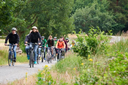
This tour runs on part of the Regionalpark Route Leinpfad through the Rheingau region. The entire time, you look directly at a backdrop of the broad river with its riverside woodlands. Of course, wine is also an important part of the Rheingau, and it is offered here at five pleasant and sociable places between Rhine km 511 and 519.
If you start the tour with a journey through the vineyards, a detour to the former Cistercian abbey Kloster Eberbach is worthwhile. It is not only an important architectural monument, but was also a centre of the wine trade in the Middle Ages. The tour then follows the Leinpfad upstream and begins at Rhine km 519.
Rhine km 519: In Mittelheim, there is a lot of ferry traffic to Rheinhessen on the other side of the Rhine. To ease the shipping traffic up and down the Rhine, the shipping channel was separated using kilometre-long stone dams to ensure sufficient water depth. In the broad Upper Rhine, many sediments are deposited before the water can force its way through the Binger Loch into the Middle Rhine Valley. The Rhine has always been an important transport axis across Europe. In the past, ships were towed upstream along the towpath by humans and horses.
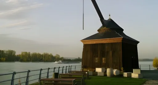
Rhine km 518: The river landscape that we enjoy today was a place of hard and also dangerous work in the past. From the middle of the 18th to the beginning of the 20th century, the Oestricher Kran was used to load wine. Labourers known as ”Kranenknechte“ who were responsible for ensuring propulsion by means of two tread wheels were often involved in accidents.
Rhine km 516: Opposite Hattenheim, you can see the Mariannenaue, a long island in the middle of the Rhine. It is part of the Inselrhein, which is very similar to a natural river course. In the still water areas, which are separated from the fairway by islands and breakwaters, countless water birds stop to rest on their way between Northern Europe and Africa. At an unpaved shore area in the Erbach woods a little further along, you get a small impression of a typical softwood meadow with botanical species such as willows and poplars, which can adjust to constantly changing water levels.
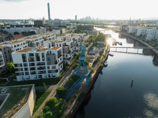
Rhine km 513: The banks of the Rhine are usually separated from the inland and towns by the Bundesstraße (federal road). You have to go through an underpass to reach the various wine regions. In Erbach, an attractive and barrier-free connection with a spatial design on both sides was created by a Regionalpark project.
Rhine km 511: In Eltville, the tour comes to an end at the Rhine promenade. At the entrance, we meet St. Nicholas, who is not only the patron saint of bargemen, but also of the coopers who lived around the Sebastiansturm tower near the Nikolausquelle spring. This is where adolescents used to meet when they could still swim in the Rhine. The nice spot surrounding two old sycamore trees was redesigned by the Regionalpark.
Here on the Leinpfad, the historical Rhine landscape is united with the centuries-old wine culture of the Rheingau region. In all the towns, we come across wine-tasting stands where you can literally taste the landscape of the Rheingau. It is a tour where you simply have to take a break – whilst drifting along the broad river between the Rhine kilometres 511 and 519.